Trail Spotlight
Golden Valley Ranch Open Space: Canyon Country's Hidden Ridgeline
Most SCV hikers know Placerita Canyon and East Walker Ranch, but the 900-plus acres above them, the Golden Valley Ranch Open Space, hold some of the best valley panoramas in the entire Santa Clarita area. Here is Sam's complete guide to the trails, the trailheads, and the views.
Loops from 3.1 to 7.5 miles Canyon Country / Placerita Canyon Sam Silver
What to Expect at Golden Valley Ranch
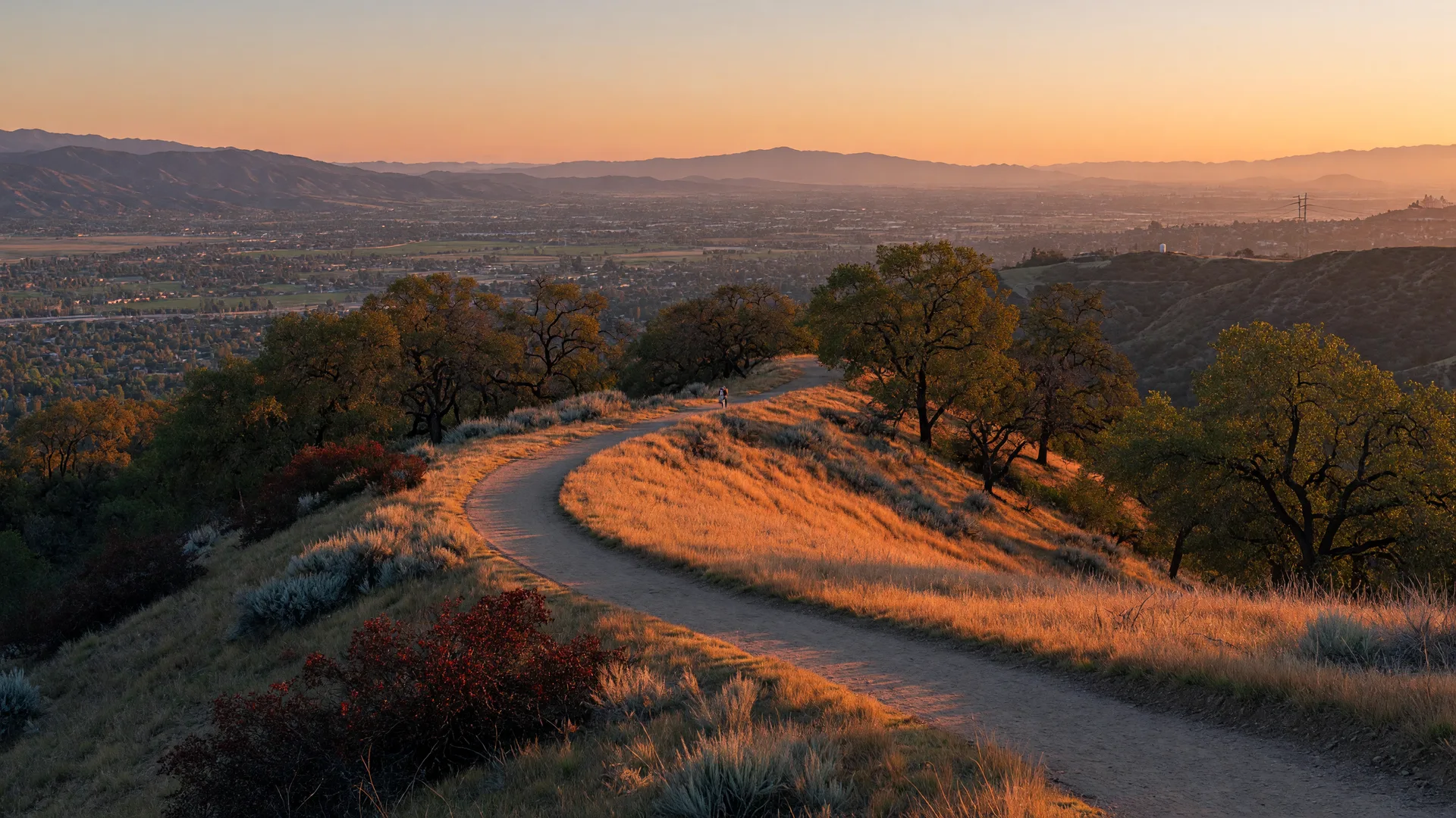
Golden Valley Ranch Open Space is a 900-plus-acre preserve managed by the City of Santa Clarita, sitting on the ridgeline between Placerita Canyon and the Santa Clarita Valley floor. It is chaparral country: golden grasses, scattered oaks, manzanita and sagebrush, with the San Gabriel Mountains rising behind it. The reward for the climb is a panorama most visitors never see, a full sweep of the valley from Canyon Country over to the Valencia hills.
The open space has two main trailheads: the Placerita Canyon Road side to the west, which climbs steeply to the ridgeline, and the Golden Valley Road side to the east, near the Nadeau Trail. From there a network of ridgeline, connector, and loop trails covers the preserve, and it links directly to the trails of the neighboring East Walker Ranch open space for longer days out.
One honest note to plan around: the preserve burned hard in the July 2016 Sand Fire, so the landscape is a recovering mosaic of young growth and open ridge. Please stay on the marked trails, exactly as the City asks, and skip any closed sections.
The Classic Loop
Nadeau & Mitchell · ~4.4 miles
About 1,076 feet of gain over 2.5 to 3 hours. Climb the Mitchell Trail to the ridge, then close the loop back down. Sam's pick for a first visit.
The Long Haul
Nadeau to Placerita · ~7.5 miles
About 1,361 feet of gain over 3.5 to 4 hours. The full ridge experience, connecting the east and west trailheads with the best panoramas in between.
The Main Ridge
Placerita Trail · ~3.4 miles
The spine of the preserve, running along the ridgeline with open views in every direction. Good with the Placerita Ridge route for an out-and-back.
Getting There
From the west: take the 14 freeway to Placerita Canyon Road, head east past the Placerita Canyon Nature Center trailheads, and look for the Golden Valley Ranch trailhead access on the south side of the road. The approach climbs onto the ridgeline, so pace yourself at the start.
From the east: use the Golden Valley Road side near the Nadeau Trailhead, which lands you on the ridgeline with the valley views almost immediately. Both entry points are free open-space access managed by the City of Santa Clarita.
Trailhead access off Placerita Canyon Road (west) and Golden Valley Road (east), Canyon Country area, CA 91387. The City's official trail map is on the Hike Santa Clarita site.
When to Go
October through April is the sweet spot. The ridges stay open and breezy, the golden grass photographs beautifully in the low winter light, and you avoid the summer heat that makes the exposed upper miles rough. On the hottest days, start before 8 AM or skip it; there is very little shade on the Placerita Trail itself.
Golden hour is the showstopper here: the whole valley floor turns amber, the mountains go pink, and the paseo lights start to blink on below. Arrive about 90 minutes before sunset and you will understand why Sam calls this the valley's best sunset hike no one talks about.
Bring water even in cool weather, tell someone your route, and carry the City's Golden Valley Trails map. Cell service is spotty on parts of the ridge.
Sam's Packing List for the Ridge
Water, 1 liter per hour
The ridge is exposed. On the 7.5-mile route, that means 2 liters minimum.
Sun protection
Hat, sunscreen, sunglasses. The chaparral offers little shade most of the year.
Grippy trail shoes
Loose gravel and steeper connectors make traction the real safety item.
Camera or phone battery
The valley panorama at golden hour is the whole reason to do this trail.
The official trail map
Download the Golden Valley Trails PDF from the City's Hike Santa Clarita site before you go.
Official trail map and conditions: Hike Santa Clarita · Golden Valley Ranch
More Hidden Trails Worth Discovering
East Walker Ranch
The 140-acre neighbor down the road, with the 1.6-mile Walker Loop. Trails connect to Golden Valley Ranch for a full day out.
Elsmere Canyon
The 2026 Hiking Challenge destination: volcanic formations, 14 creek crossings, and hidden history off the 14.
More Hidden Gems
Five lesser-known family-friendly trails across the valley, hand-picked by Sam.
Hiking the Valley, Neighborhood by Neighborhood
Sam has hiked, run, and biked the SCV for 22 years, and he loves matching neighbors with the right outdoor spot for their lifestyle. Thinking about living closer to the open space? He knows which Canyon Country, Placerita, and Valencia neighborhoods back right up against it.