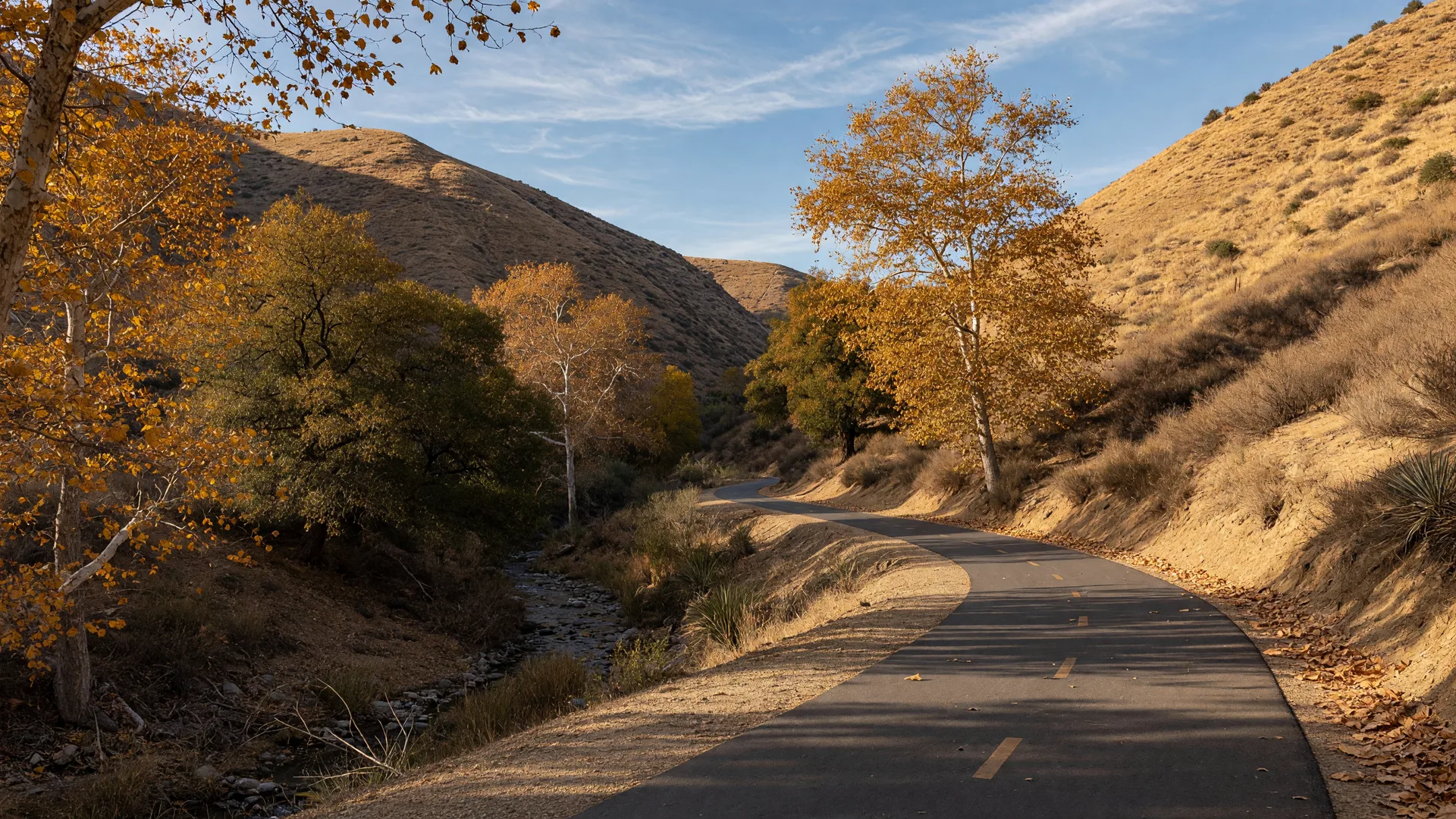
Trail Spotlight
Bouquet Canyon Trail: Two Great Outings, One Name
Bouquet Canyon Trail is really two trails in the SCV: the city's brand-new paved path that links Saugus to Central Park, and the short, sweet Bouquet Falls hike in the Angeles National Forest. Both are easy, family-friendly, and genuinely underrated. Here is Sam's complete guide to each.
0.7 mi paved path · 0.5-0.8 mi falls hike Saugus / Angeles National Forest Sam Silver
Why Bouquet Canyon Has Two Trail Stories
Bouquet Canyon Road runs from the valley floor north into the mountains, and along its length you will find two very different trails sharing the same name. The first is the City of Santa Clarita's Bouquet Canyon Trail, a smooth shared-use path that opened in November 2024 along the Bouquet Creek channel, built for walkers, joggers, and cyclists. The second is the Bouquet Falls Trail in the Angeles National Forest, a short canyon hike to a seasonal waterfall. Both are easy, both are free or nearly free, and together they give you a paved city outing and a proper forest hike in the same afternoon.
One honest note up front: the two trailheads are about 15 minutes apart by car, so this is really two separate adventures along one scenic road, not one continuous route. Plan each as its own outing and you will enjoy both a lot more.
The City's New Paved Trail
The Bouquet Canyon Trail is a 0.7-mile shared-use path built along the Bouquet Creek Channel maintenance access road, running from Bouquet Canyon Road near Espuella Drive south to Central Park. It opened in November 2024 and instantly became one of the easiest ways to reach the valley's biggest park on foot or by bike.
The path is paved, flat, and wide enough for strollers, scooters, and family bikes, and it connects into the larger paved network that already serves Central Park and the surrounding Saugus neighborhoods. TrailLink also maps a longer 3.6-mile asphalt segment of the Bouquet Canyon Trail between the Newhall Ranch Road and Vanderbilt Way area and Bouquet Canyon Road at Bouquet Creek, so the corridor keeps growing.
Sam's take: this is the perfect warm-up loop before a Central Park picnic day, and it pairs beautifully with the park's playgrounds and the valley's wider paseo network.
The Bouquet Falls Hike
Head north up Bouquet Canyon Road into the national forest and you will find the Bouquet Falls Trail, a short out-and-back of about 0.5 to 0.8 mile with only about 91 feet of elevation gain. It is an easy 25-minute stroll through oak and chaparral to a small seasonal waterfall, and it is one of the closest waterfall hikes to the valley.
The trailhead sits at 35191 Bouquet Canyon Road. Parking is a small lot next to nearby homes, so be quiet and respectful of the neighbors, and note that a National Forest Adventure Pass is required for parking in the forest. The trail is dog-friendly, and the waterfall is at its best in spring and after good winter rain, so time your visit accordingly.
In dry months the falls can slow to a trickle. Check recent trip reports before you drive up, and treat the hike itself as the reward either way.
Bouquet Reservoir & the Canyon's History
Farther up the canyon sits Bouquet Reservoir, an artificial lake in the Angeles National Forest built by the Los Angeles Department of Water and Power. The dam was completed in 1934 as part of the Los Angeles Aqueduct system, with a capacity of roughly 36,000 acre-feet, and it was built to replace the St. Francis Dam after its catastrophic failure in 1928. It is a working drinking-water reservoir, so swimming is not allowed, but the views from the surrounding ridges are spectacular.
For hikers who want more than the falls, the Pacific Crest Trail Bouquet Canyon route is a moderate 5.7 to 6.6-mile loop with about 1,400 to 1,700 feet of gain, passing old movie ranches and oak woodlands with views down to the reservoir. It is rocky in places, so bring trekking poles and start early, and the same Adventure Pass rules apply.
Dam Completed
1934
Built by the LA Department of Water and Power for the aqueduct system.
Capacity
~36,000 acre-feet
A working drinking-water reservoir, so no swimming.
The Long Loop
PCT · 5.7-6.6 mi
Moderate ridgeline loop with reservoir views. Trekking poles recommended.
When to Go
October through April is the sweet spot for both trails. The paved city path is pleasant year-round, but the canyon hikes are best in the cooler months, and the falls need winter or spring rain to really run. Autumn brings golden sycamores along the creek, which makes the paved trail a photographer's favorite in late afternoon.
Summer is doable early in the morning, but the forest trails are exposed and hot by midday. On a warm day, stick to the shaded creek sections and save the ridgeline loop for fall.
Sam's Packing List
Water, even on short hikes
The falls trail is short, but the PCT loop is a real outing. Bring a liter per person minimum.
National Forest Adventure Pass
Required for parking at Bouquet Falls and the PCT trailhead. Pick one up at local outdoor retailers or the forest service office.
Grippy shoes for the forest
The falls trail can be damp and rocky near the water. Trail shoes beat sneakers.
Camera for the creek light
Golden sycamores along the paved trail and the falls in spring are both worth capturing.
More Trails Worth Your Weekend
Hidden Hiking Trails
Five lesser-known family-friendly trails across the valley, hand-picked by Sam.
Paved Trails & Paseos
The full guide to the valley's paved path network, perfect for bikes, strollers, and jogs.
Castaic Lake Recreation
Boating, fishing, camping, and trails at the valley's biggest lake, just up the road.
Find the Neighborhood That Matches Your Trail
Sam has hiked and biked Bouquet Canyon for 22 years, and he knows exactly which Saugus, Castaic, and Canyon Country neighborhoods put the best trailheads at your doorstep. Whether you want the paved path for daily rides or the forest for weekend escapes, he can help you find the right fit.